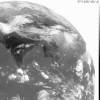
Weather satellite images of the Russian region
Space Monitoring Information Support Laboratory
SMIS is one of the Space Research Institute laboratories, formerly conducting atmospheric research. SMIS is now working in the area of information technologies for remote sensing and is making available a range of images of the Russian region together with other data acquired by Russian ground stations.
Many of these sites are under development. Data and images available may be subject to change!
Images and Weather Maps for the Russian region
Daily pictures of the European part of Russia, Western Siberia and North East Europe
Nizhnii Novgorod region - current data
Sample images from SMIS Moscow
Russian sites are developing rapidly. A wide range of data is available - but you may need to search for it! Direct access to data is available. Data is stored in directories and files may be selected by clicking on the file name.
Useful data areas include: (hint: to download image files click on files shown as *.gif!)
-
Today - current maps and data
Moscow region
GOMS satellite data
Flood96 (areas prone to flooding in the snow melt season)
Directories containing maps/images for each month are also available (96-05, 96-06 etc)
GOMS - Geostationary Operational Meteorological Satellite
GOMS provides some geostationary images from a position at 60° East.
Page update: January 12th 1999
This version: © St. Vincent College
