Weather Charts
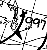
 Surface pressure chart - UK Met. Office: Bracknell
Synoptic or Pressure Charts
The pressure chart shows the distribution of atmospheric pressure. Pressure systems - depressions (LOW pressure regions) and anticyclones (HIGH pressure) are marked and Isobars are drawn on the chart to link areas with the same pressure. Isobar lines are drawn at 4mB interval (4 HPa) and weather frontal systems are marked using standard symbols.
 Cold front |  Warm front |  Occluded front |
Wind direction and some indication of strength can be deduced from the pressure chart. In the Northern Hemisphere, winds blow in an anti-clockwise direction around a depression (LOW) and in a clockwise direction around an anticyclone (HIGH). The closer the isobars are together, then the greater the pressure gradient and the higher will be the wind strength.
Pressure charts are a useful help in interpreting satellite images. The satellite image shows the pattern of cloud cover and with the help of the pressure chart, frontal systems can be identified and tracked over a period of time. Typically, rain will be associated with the passage of a front - identifying and tracking the fronts can allow the forecast of rain, changes of temperature, wind direction and speed etc.
| Surface pressure charts from the UK Met. Office. | |
 |
Charts are updated daily services) and show isobars, pressure systems, frontal systems etc. These charts are based on observations and show current weather conditions.
Current surface pressure chart |
| Visible light satellite image - UK Met. Office | |

|
Download latest visible light images Latest sequence of images from the Met. Office in Visible light and Infra-Red - animated sequences available. |
| (Surface pressure and satellite image shown for the same day - June 12th 1997) | |
Weather Charts
Other weather chart information:
- Forecast charts - conditions for the short and medium future
- Weather station report charts - current conditions

![]() Weather charts index and links page
Weather charts index and links page
Page update:
This version: © Peter Milford